Just sharing some pictures we took today... Click the pictures to see an enlarged version....
My Mom
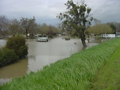
came by this morning to visit and drop off some things that I’m borrowing for a bit to help me with a move I'm making. After showing her the place I'm planning on moving to we decided to take a drive up the river to see how some of the marinas are faring with the high water. My daughter and grandson decided to come along too, so we all piled into my car and headed up river on the levee road. The first marina upriver from Meridian is Lovey’s Landing. All that area you see under water is normally filled with trailers and campers. Fishermen and women usually live there year round to be close to the fishing. One of the folks who has been living at Lovey’s is now staying with a friend across the street from me here in Meridian. From what he told me and another friend, he's planning on renting a house here in town rather than moving his trailer back up to Lovey's when the river goes down.

One of the trailers didn’t make it out of the low area before the water level came up...
Most of the rest of the RVs and trailers got pulled out of the low area to the levee road.. They'll sit there until the water goes back down and the ground dries a bit..
The next marina upriver is Ward's Landing, and as you can see from the picture, they've got the river in their yard too.
Check out the angle the ramp to the dock is at.. The ramp normally follows the slope of the levee down and across to where the docks usually are, but with the high water, the ramp goes up, bends in the middle and then down again to the dock which is almost at the same level as the higher part of the parking lot.
Just upriver from Ward's is what is usually a dirt parking lot where folks store their boats, RV's and other equipment... All we saw was one lonely sunken boat trailer.
As we drove up the levee road, we looked out across some of the farmland that is underwater... It's not deep, but there are acres and acres under water right now.
The water fowl in the area are loving the high water. We saw dozens and dozens of snowy egrets wading in the shallow water or flying away from the noise of my 4x4 on the road. My daughter got a few really nice shots of the birds out the passenger side window.
The trees in this orchard must be terribly confused. They're in full bloom and absolutely flooded by the Sacramento River.
See that long black thing out beyond the small trees on the "shore"? It was rushing downriver with the current.. Tree? Long support beam from something? We don't know, but after seeing lots of trees, limbs along with that thing floating down the river, no one needed to wonder why there aren't any boats in the river.
The next marina (and the last one we drove past today) is the Colusa Landing.. Just a couple weeks ago, my Mom, my granddaughter from Utah and I were there for lunch. They had sandbags at that time, but not like they have now. And there wasn't water in the parking lot beyond the restaurant then, either.
I walked down near the water to get a picture of the deck on the river side of the restaurant so my granddaughter can see what it looks like now... When we were there, the water wasn't even close to the restaurant. Today, however it's close.. And there's evidence that the water has been even higher. The spot I was standing to take this picture was under water just a day or two ago.
There's no access to the docks at Colusa Landing right now.. The water is just a wee bit deep...
Well, that's the end of the "tour" for today... After leaving Colusa Landing and the Steelhead Lodge, we headed on in to Colusa in search of a late lunch, which we found... And then back home for all of us... Hope you've enjoyed the tour of our flooded river! I may have to do another tour once the water goes down and life returns to normal... Hmm.. Yeah, that might be a nice thing to do with my granddaughters when the granddaughter from Utah comes back to visit this summer.

 came by this morning to visit and drop off some things that I’m borrowing for a bit to help me with a move I'm making. After showing her the place I'm planning on moving to we decided to take a drive up the river to see how some of the marinas are faring with the high water. My daughter and grandson decided to come along too, so we all piled into my car and headed up river on the levee road. The first marina upriver from Meridian is Lovey’s Landing. All that area you see under water is normally filled with trailers and campers. Fishermen and women usually live there year round to be close to the fishing. One of the folks who has been living at Lovey’s is now staying with a friend across the street from me here in Meridian. From what he told me and another friend, he's planning on renting a house here in town rather than moving his trailer back up to Lovey's when the river goes down.
 One of the trailers didn’t make it out of the low area before the water level came up...





 Posts
Posts

